
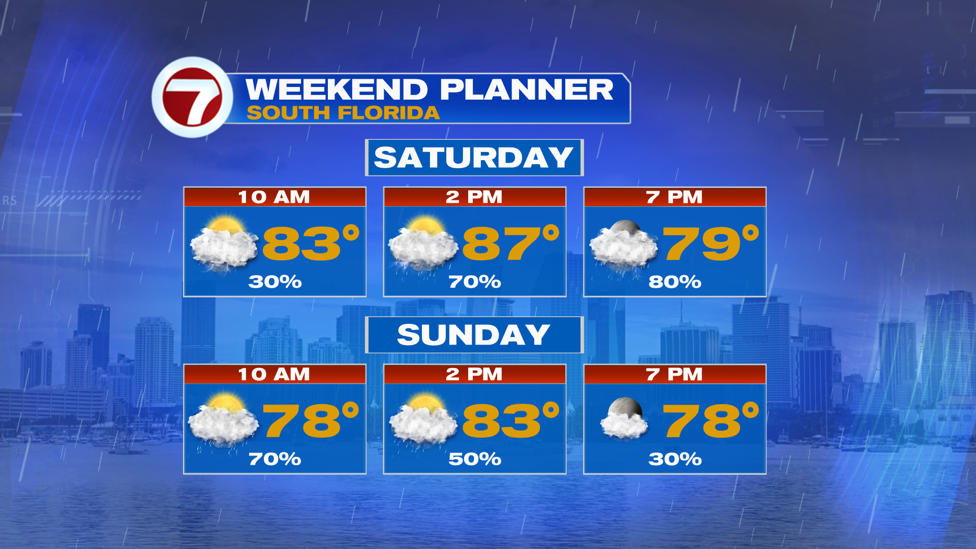
South Florida is heading into a wet and windy weekend as a cold front approaches. While scattered showers and storms will gradually wind down tonight, Saturday is shaping up to be our biggest weather impact day.
After a brief break in the rain Saturday morning, widespread showers and thunderstorms are expected to develop as tropical moisture increases ahead of the front.
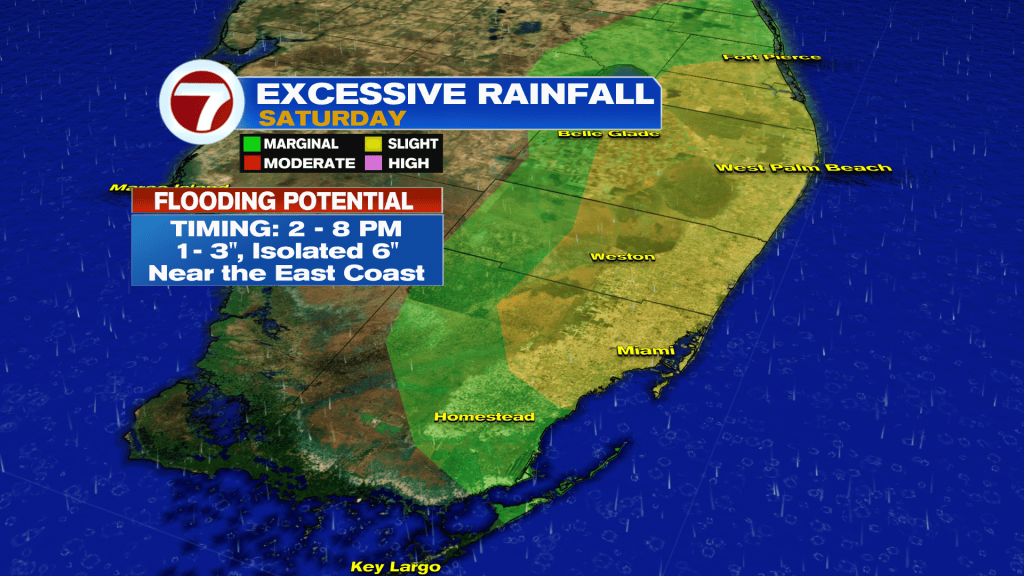
The greatest concern for heavy rainfall will be across the East Coast metro areas, particularly between 2pm and 8pm Saturday.
Rainfall totals of 1–3 inches are forecast, with isolated amounts up to 6 inches possible. Coastal Palm Beach County could see some of the highest totals. With already wet ground across portions of Broward and Palm Beach counties, localized flooding is possible, especially in low-lying and flood-prone areas.
Showers and storms may linger Sunday as the front moves through, but rain chances should gradually decrease as drier air arrives.
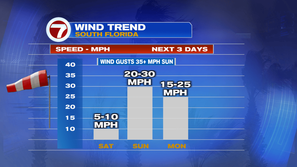
Our attention then turns to strengthening north-to-northeast winds. Gusts of 20–30 mph are possible Sunday into early next week, with hazardous marine conditions developing.
A Small Craft Advisory is in effect for local waters beginning late Saturday through early Monday, with seas potentially building to 7–10 feet or higher. Wind gusts could also approach gale force.
Temperatures will become more comfortable, with highs in the low to mid 80’s.
Stay with 7Weather for the latest updates!
Vivian Gonzalez
Meteorologist, AMS Certified
WSVN Channel 7


